QNH |
|
| THE toolbox of the VFR pilot | |
QNH |
|
| THE toolbox of the VFR pilot | |
|
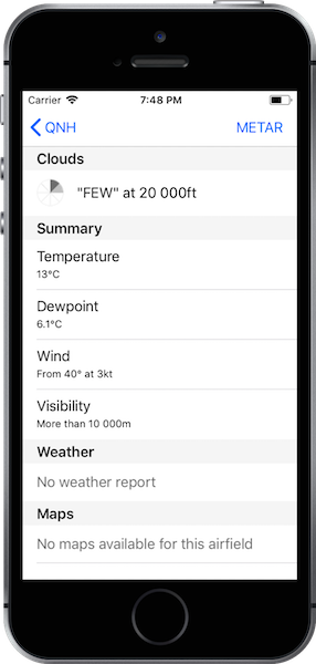
Weather With QNH, you could in some seconds get every informations concerning the weather on your favourite airports. Clouds, temperature, dewpoint, visual range, atmospheric pressure, maps and trends, every informations are there. *Only available for some countries |
|
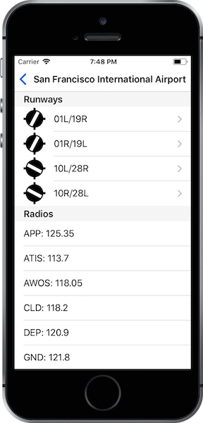
Airport Radio frequencies, runways threshold or dimensions, waypoints, even without an internet connection, you could access to informations about more of 44.000 airfields all around the world, or more of 27.000 radios and more of 77.000 runways. |
|
|
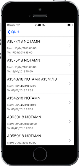
NOTAMs You can easily get informed by every NOTAMS of your favourite airports. |
|
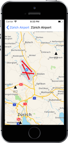
MAP Maps are more or less available depending on the region of the airfield. You could access to different airport maps, weather maps or navigate on a map showing more of 3500 waypoints. |
|
Copyright (C) 2016 - 2018, Maxime Madrau, All Rights Reserved